Victoria > East Coast
Craigie Rd, Mt Martha
| Type | Coastal Cliff |
| Conditions | WSW-WNW |
| Height | 100'/ 30m asl |
| Rating | PG5, PG4 Endorsed (Other PG4 under supervision) / HG Advanced |


Melways Map 145 B7. Opposite Morrisons Rd.
Landowners - ?
Contact/Responsible
Skyhigh , MHGCDescription

Site endorsement is required for paragliders pilots and authorisation by a PG5 (endorsed), or FI/CFI/SSO. The name and SAFA numbers of the applicant and authorised endorser will be required. Please complete the observations onsite with the authorised endorser. See here.
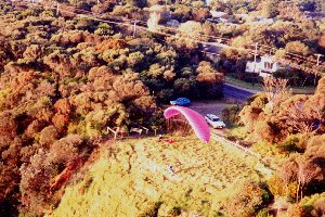
Takeoff
The take off is in the grassed area behind the fence. Access is through locked gate.
(Note: Gate must remain locked at all times)
Launching is typical done from standing on the slope in lighter conditions to further in the hollow a few meters down the slope in stronger conditions.
There is no safe landing below or to the left of launch. Before launching ensure that the wind direction and strength are sufficient to clear the terrain at the right in order to reach a safe landing area on Bird Rock beach.
Before launching check that the wind is not coming from the direction of the headland just to the right of launch. This headland causes strong sink and rotor. After inflating the wing but before committing to launch it is recommended that the pilot should “feel” for the effect of rotor on the wing.
After launching, build some height in front of the launch before trying to go off to the right towards the landing zone, due to possible sink and or rotor from the point out in front. (Refer to hazards.)
Limited parking of only six vehicles so be considerate of locals by using the main road or alternative parking location only 180 meters walk via path.
To obtain the gate lock combination, log onto the members only section of the SAFA website. From the side menu, select Documents, then Operational Information. Download and view the Flinders Monument PDF file. Alternatively, contact either the Skyhigh or MHGC club site officers for the latest combination, but only if your membership is current.
Landing
The main bottom landing is on the beach around the point to the right from launch. Generally the wind will have some south in it so approach with height and land in a southerly direction.
Experienced pilots may top land on launch in appropriate conditions only.
Hang gliders can land on the beach at Mt Martha (2km south of take off) or the main landing beach beyond the point to the right of take off (there's a steep track you can carry back up on).
The “beach“ to the left of launch, beyond “Pyramid Rock” is for emergency landing only. It has various obstructions and is bordered by a sea wall.
Top Landing on launch is also possible, but a number of factors need to be considered-
- Powerlines behind launch along road.
- The Busy road immediately behind launch
- Houses behind launch
- Rotor points from tall trees neighbouring launch
- Lack of a bottom landing options if the wind is dropping off or going crossed
Flight
The main beat for paragliders is the coastline to the right of launch along the cliffs of Birdrock beach and beyond. After Dava beach the pilot needs to carefully evaluate flying conditions and landing options.
In favourable conditions it’s also possible to soar the cliffs to the left of launch, but if conditions change it may not be possible to reach a safe landing. Pilots have been caught out this way more than once.
Keep an eye on the wind lines. In general, the winds on the bay tend more southerly with time. You should be able to see a southerly swing coming and make it to the appropriate landing area before it gets to you.
Hazards / Comments
- The point just to the right of launch can cause sink and or rotor depending wind strength and direction. Be sure to cross this area with adequate height building height on the ridge to the left of launch.
- The small peak off to the left of launch and forward of the main ridge known as the “Pyramid” also can cause sink and or rotor depending on wind strength and direction. Avoid flying low behind.
- Lack of landing options if wind drops off or goes crossed. There are options but limited space and used by public.
Weather…
The bay has its own unique weather patterns especially when it has more westerly component to it. It is not uncommon to see gust fronts of 25 knots to suddenly appear and on occasions gust fronts of 40 knots do come through likely due to topography of west coast out front. Excellent situation awareness is needed.
Toplanding consider-
- Powerlines behind launch along road.
- Busy road along ridge
- Houses behind launch
- Rotor points from tall trees
- Lack of bottom landing options if wind is dropping off or going crossed