Western Australia > Wheatbelt
The Range, Toodyay
Due to change of ownership from 30 June 2007 the previous arrangement for permission to use this site has lapsed. The new owner has requested no-one enter the property. HGAWA representatives will be meeting with the new owners to try to get permission to use the site for flying again. In the meantime no-one is to enter the site. Please spread the word to pilots who may not be aware of this, to ensure no-one inadvertently enters the site without permission. This web page will be updated as soon as the status changes. Check with the HGAWA (Rick Williams) or your club if you want to check on the current status.

| Type | Inland Ridge |
| Conditions | WSW-WNW |
| Height | 300ft / 90m agl |
| Rating | PG: Supervised; HG: Intermediate theory + 15 hours |
Located near Toodyay, 1.5 hours east of Perth. If you haven't been here before, contact Cloudbase Paragliding Club, check on the current access arrangements, and preferably organise your first flight with a club member who has good knowledge of this site. This site is privately owned, so is sensitive and could easily be lost.
Landowners
Private
Contact/Responsible
HGAWALanding
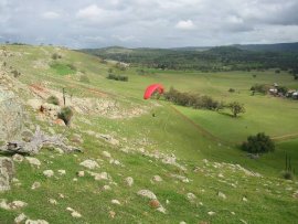
There is a good bottom landing for paragliders immediately in front of launch - avoid big bush/tree at base of ridge. This paddock does have considerable downhill slope however, and can be tricky for hanggliders. The owners have requested that all flyers land in this paddock if possible, and that no-one drive by the house to pickup pilots and gear (October 2004). In future when this bottom-landing paddock is in crop permission may be given to land in the paddock near the house. Beware of the slope on that paddock, and rotor from trees at the upwind end.
Top landing is good, with minimal rotor and turbulence behind take off area. Never attempt to land behind or even approach behind the hill right of take-off. In fair weather the large bottom and top-landing area facilitates an excellent trainee and novice site with light weather bomb outs good for directions north to southwest.
Flight
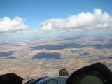
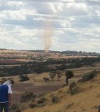
This site is generally safe to fly, but being a low inland site it is much more dangerous in the warmer seasons. The turbulence generated at this site in summer - even on a cool day with a good westerly wind - can be significant. Only fly this site in summer if you have a lot of inland experience.
There is now a weather station on top of the hill. You can get a wind report by dialling 0410 392 664 or four clicks on UHF channel 12. the station only operates in daylight.
Keep a good clearance from the hill at all times, remember this is not a coastal site, sink and turbulence are not unusual and the rocky hillside is very unforgiving if you hit it.
Advanced pilots can launch from the far southern end of the ridge in northwesterly winds, the lift there is good but the takeoff is hazardous as it is flat and rocky.
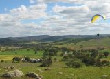
Threads of lift can often be followed well upwind out over the farmhouse or even as far as the road. It is difficult to get away cross country as the small height of the hill means it is mostly flyable when the wind is too strong for good thermal formation, but it is occasionally possible to get over the back for some good cross country flying.
Site Records: PG: Open distance Eric Metrot 100km+; HG:?


Hazards / Comments
As all inland sites, this site has the potential to be treacherous; the small height of the hill makes it particularly hazardous in strong thermic conditions. The site is at its best with a westerly in the evenings.
Care should be taken to avoid being blown back at the far north or south end of the site that due to the shape of the ridge develops a rotor.
There is a large bush/tree on the bottom of the ridge (just left of take off line), which always generates turbulence. This turbulence can extend right up the face of the ridge so give it plenty of room. There's also often a patch of funny air to the right of take off, possibly due to the large gum trees in front.
The rocks at the top can make launching hazardous if the lift is not good, be sure to have a look over the edge at your intended launch point before setting up.
