Victoria > East Inland
Gundowring (Savhill)

| Type | Inland ridge |
| Conditions | NNW, SSW |
| Height | 2100' / 640m amsl, 1310' / 400m agl |
| Rating | PG4/HG Supervised, PG2 Require PG4 supervision, PG3 must be in the company of PG4, HG Sup require HG Int Supervision |


Approximately 39 kms north of Mt Beauty and also 39km, as the paraglider flies, from Bright. The turn off from the road is at S36.3829, E147.0668.
000 Emergency Markers (?)
- GUN100: SW-NW launch
- GUN200: Landing
Landowners
Adam and Kristy Szabolics
Contact
Bob Saville, Martin JoyceResponsible
NEVHGCDescription
This site has huge potential with reliable valley winds and thermals. If you fly the hill let people know by posting on the Victorian forums such as NEVHGC (Whatsapp) or MHGC forums.
Access
The access track from the Gundowring Road is passable only for 4WD/AWD vehicles (High clearance may be required if track is rutted. Check first with local pilots as AWD or low clearance vehicles could become stuck and lead to further track damage). All other vehicles are to be left at the front gate. Trailers may be taken to the LZ but not up to launch. Use low ratio drive when ascending to launch. This is to prevent damage to the track.
Any flying or driving on the property is at your own risk. This is a free site but all pilots must be current members of SAFA. Membership of other clubs is not required.
This site was established by Bob Saville who ran it for some 10 years before selling to Adam and Kristy Szabolics in 2018. The new owners are very happy for us to continue using the site provided that we follow the usual courtesies:
- Leave gates as found
- Leave no litter
- Strictly no smoking on the property and no fires
- Use only 4WD/AWD vehicles on the property and do not take trailers beyond the LZ
- Do not park vehicles in long grass during the fire season.
- No camping except by prior approval. Please contact Bob Saville or Martin Joyce.
- Motorcycles are not allowed to be ridden on the property at any time.
The site is only available to us because of the generosity of the owners. If they are on the property take time to say hello and thank them for their support.
Takeoff
The hill has an open grassy launch to the SW-NW. Please feel free to help by pulling up weeds, clearing rocks, etc.
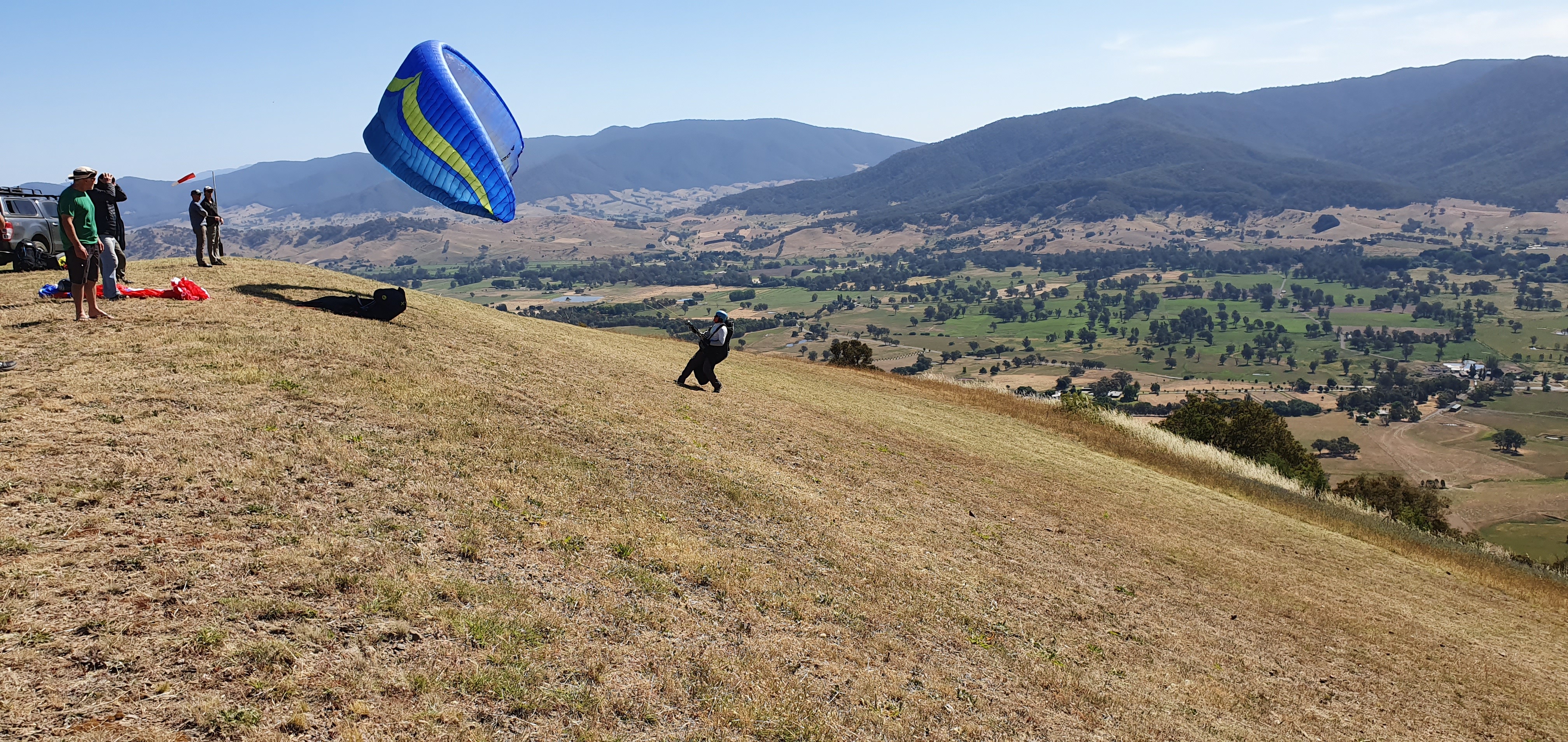
SW-NW launch
The main SW-NW launch is a large and open grassy area with clear aspects from SSW to NNW. It presents excellent opportunities for ridge soaring in westerly winds to thermal soaring. Be aware of air space restrictions in relation to Albury airfield some 50km to the north.
Feel free to clean up the launch area if you are waiting for conditions to improve.
Landing
The nearby blue-zones (preferred landing areas) are owned by Aaron and Ange Ibbott and their neighbours. The Ibbots live in the main farmhouse directly in front of launch. They are happy for anyone to land on their property but out of courtesy we avoid their driveway area and its associated power lines. Again, take time to have a chat with them if they are nearby. The area to the north is slightly sloping down towards the main road. (That's the paddock you have to drive through to get to the hill.) The paddock to the south nearest the hill is reasonably flat, has a windsock and there is an unlocked gate on the border fence. They ask us not to land in the smaller paddock in the middle if there are cattle in it. All the farmers in the vicinity are happy for an occasional landing, the exception being a large red (no landing) zone some 6km to the south. Please observe all the usual courtesies so that we can continue to enjoy the many landing options all the way to Mt. Beauty.
Flight
Cross country, ridge and thermal soaring.
For paragliders if you arrive early and the wind is picking up get ready to launch. The wind can be quite strong at midday then eases off around 13:30 or 14:00hrs. Thermals come through consistently and it is possible to launch to the west even when the wind is from the north. Take care if top landing near the end of the day, the winds can quickly become katabatic and catch you out.
Hazards / Comments
There are no toilets on the hill. Please be discrete. Ideally dig a hole, do the toilet and fill in the hole. Driving on the property is at your own risk. Do not leave the cut track. Use low ratio when ascending to launch. While on the property have your radio on CH 28 Tone 97.4. If there are others on the hill they will be monitoring which will be useful for avoiding other traffic; there are not many passing places on the track. Before making a journey either up or down make a radio call to check if there is any other traffic on the hill. There has been much work completed recently (2019-20) to improve the track which now needs to bed down so please take care and drive responsibly.
Map information
