Victoria > East Inland
Tawonga Gap

| Type | Inland mountain ridge |
| Conditions | NE |
| Height | 3182' / 970m amsl, 610m / 2000ft agl |
| Rating | PG4 / HG Advanced. PG2 and PG3 require FI/SSO supervision. HG Sup and HG Int require HG Adv supervision. |
Overlooking Tawonga. To find the launch travel the road between Bright and Mt Beauty at the very top of the ridge crossing the road switchbacks and heads down the other side of the ridge. At the switch back, take the track up the hill located right on the blind corner. Be careful driving in or out of this track. The launch is located approx 1km up on the left of the track. Vicroads Map 50 C5.
000 Emergency Markers (?)
- TAW100: Launch
Landowners
Vic Govt, DSE (Dept Sustainability & Environment). This site is licensed to VHPA, Refer DSE Licence on VHPA 'downloads' page.
Contact
Dave Coleman (PG) (0451 653 751)Responsible
NEVHGC , VHPADescription
A tree slot launch on a large inland ridge. Located on the western side of the Kiewa Valley.
Takeoff
Although close to a main road, launch itself can be difficult to find. Its recommended to take a guide with you. There are 2 lookouts on the Bright Gap Rd. To find launch, locate the higher lookout (it has a viewing ramp sticking out from the ridge and a round shaped parking area). Opposite the lookout, drive up the steep rocky dirt track from the hairpin bend in the main road for about 1km. The first part of the track is very rough and needs care not to ground out your car on the rocks. 4WD is not necessary but a car with adequate ground clearance is advisable. A Subaru Forester or Outback will do it easy. Near the top, there will be a clearing where you can turn the car around. Do this here and drive back downhill 200m or so stopping when you see some steps cut into the embankment on your right. That is the walking track to launch.
Be careful driving in or out of this track. Watch for traffic as the intersection with the main road is a blind corner!
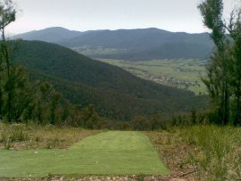
Launch is an earth ramp through a tree slot.
Landing
The Tawonga Gap LZ, Iaria's Paddock, quite often has stock in it and the trees around the southern boundary have gotten quite tall. There is a fence running west to east dividing the paddock in half. It is highly recommend pilots have a good look at it before committing to land there and before travelling up to launch. Hang gliders generally land at the Mt Beauty airstrip instead.
The landing paddock is out of sight when on launch. It is located along the eastern side of the Kiewa Valley Highway travelling into Mt Beauty township approximately 1km from the Bright turnoff.
Before going XC, please check the map for allowed and forbidden landing paddocks in the area.
Flight
This site is often 'on' much earlier than Mt Emu located on the opposite of the Kiewa Valley. Much like Mt Emu, the entire Kiewa Valley and beyond can be explored. Crossings to Bright and Mt Buffalo are possible.
Hazards / Comments
The LZ can't be seen from launch. High tension powerlines run along this side of the valley and are visible from launch.