Flying Tasmania
Introduction to Flying in Tasmania
Iain Clarke – President, Tasmanian Hang Gliding and Paragliding Association (THPA)
In Tasmania, the Tasmanian Hang Gliding and Paragliding Association (thpa.org.au, facebook.com/groups/THPA.org.au) take care of things. We welcome visitors but, as most of our sites are on private property, we absolutely insist you get in touch with us so we can show you around and brief you on the site protocols. We are not shy in referring pilots who do not follow this request to the SAFA for sanction, and we make no apologies for this. People that do so risk all of us losing these sites and deserve what they get. Take the time to visit the links above to obtain contact information.
We have a small but active community down here with 48 PGers and 10 HGers. Pilots are scattered throughout the island with a concentration in and around the capital of Hobart down south, and a very active contingent on the north-west coast.
The state can be broadly divided into three main flying areas: North-west Coast, Midlands and South.
The NW Coast is blessed with a delightful mix of coastal flying sites that take pretty much any of the main wind directions, from west through north to east. The coast is also blessed with the most consistent flying conditions. While the rest of us suffer patchy seasons with low flight hours, the folk up NW are in the air. The familiar refrain of ‘The Don is on’, causes much jealousy down south. In the 2015/2016 season Dave Luttrell scored 120+ hours up on the coast. He’s a bastard.
An hour by road from the NW coast lies the Midlands region. This is an area of hills, plains, farms and forests that extends south towards the Hobart. It is bounded on the western side by the Central Plateau, and on the eastern side by the Eastern Tiers, a line of forested hills and valleys which extend to the east coast. The walls of the plateau, known as the Great Western Tiers, is the home of the launch site where a lot of XC flights originate - Tunbridge Tier. Indeed, the Tasmanian PG distance record flight by Macin Tobiszewski (93 km, 2011) commenced here. It is, however, PG5/HG Advanced rated and doesn’t take prisoners. The hills and plains surrounding it provide plenty of thermal sources and triggers, and new routes get tried each season. Check out this video by Gary Stockton.
There are several hills throughout the Midlands, and that closest to Hobart which deserves a mention is Kempton. With three launches, it is a reasonably benign site, suitable for lower rated pilots to cut their teeth on thermalling and improve their skills. Large XC flights (79 km – Pete Steane) have also originated from here, so on a good day with a NE/E air stream it is very popular, with sometimes nearly a dozen pilots in the air at one time.
Once out of the Midlands you’re down South. Mt. Wellington/kunanyi dominates the skyline of Hobart and has a PG5/HG Adv launch. The flight is also the largest vertical descent in Australia. Just north of Hobart, at the gateway to the Midlands is Winton, a 5 km long crescent ridge. The southern bread and butter site, good for ridge soaring in not too strong sea breezes, also for thermalling. On the right day XC flights are very possible (max. from here – 67 km by Ky Wittich). It is rated as PG 2/HG Novice upwards.
Further to the east on the isthmus joining two peninsulas, is Eaglehawk Neck, with a low rated launch above the high tide mark, and a more advanced launch on the summit of the big hill overlooking the sea.
The Derwent Valley, running north from Hobart, through which the river Hobart surrounds descends, has several sites of varying grade. New sites throughout the Derwent Valley and in the Midlands are being discovered, all just waiting the right conditions to test the potential.
For truly majestic scenery, the hike and fly crowd should head to the South-west.
NW Coast:
Don Heads – aka ‘The Don’
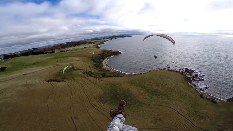 Figure 1: The Don, looking west. L-R: Steve Kent, Steve Overton, Dan Wilson. Pic: Dave Luttrell.
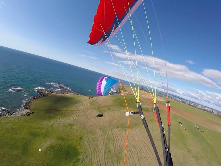 Figure 2: The Don, looking east. Gary Stockton (l), Iain Clarke (r). Pic: Dave Luttrell.
Fossil Bluff/Table Cape
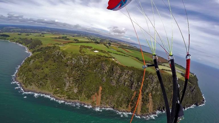 Figure 3: Table Cape. Pic: Dave Luttrell.
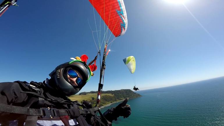 Figure 4: Christmas in Tassie, from Fossil Bluff looking west towards Table Cape. Dave Luttrel (l) & Steve Overton (r). Pic:
Dave Luttrell.
Figure 4: Christmas in Tassie, from Fossil Bluff looking west towards Table Cape. Dave Luttrel (l) & Steve Overton (r). Pic:
Dave Luttrell.
Green Hills
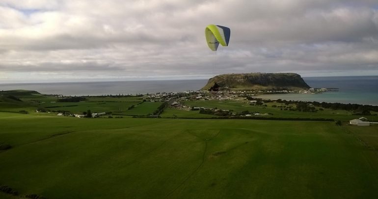 Figure 5: Steve Overton, in front of The Nut and Stanley, from Green Hills. Pic: Dave Luttrell.
Rocky Cape
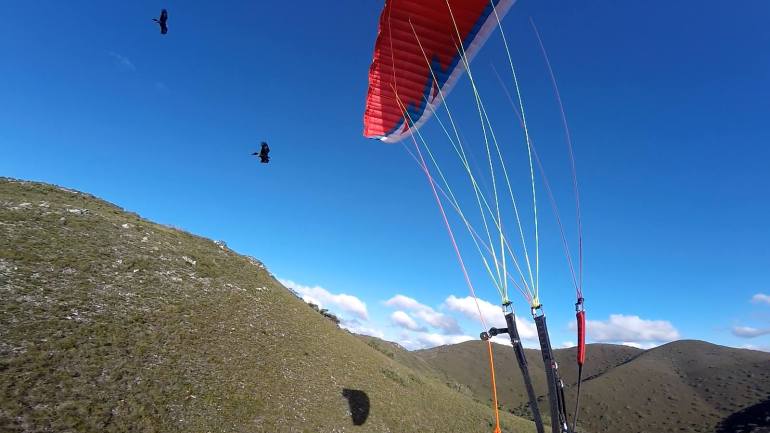 Figure 6: Friends and foes – Wedge-tailed Eagles at Rocky Cape. Pic: Dave Luttrell.
The Midlands:
Tunbridge Tier
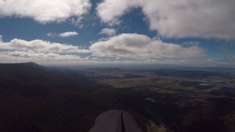 Figure 7: Heading north along Tunbridge Tier on the last day of Winter, 2017. Pic: Phil Joughin.
Kempton
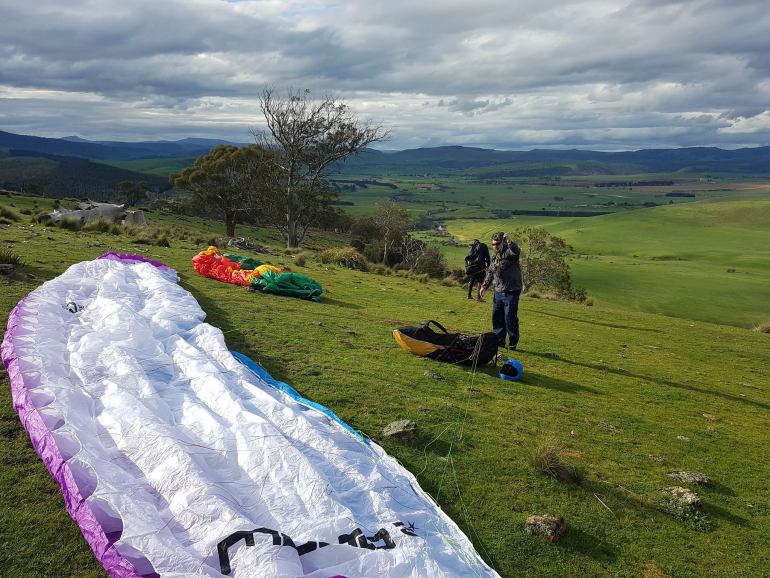 Figure 8: John Middendorf (l) and Iain Clarke (r) setting up at Kempton's Wilderness launch. Pic: Rob Steane.
Down South:
Winton
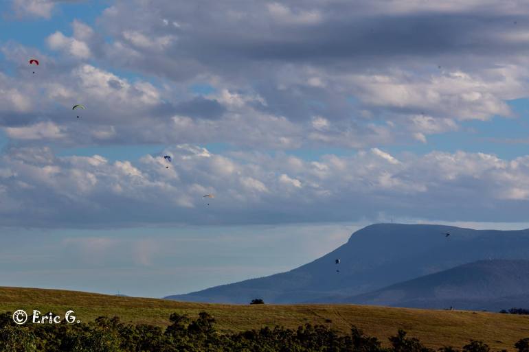 Figure 9: A small gaggle over Winton, with Mt. Wellington/kunyani photobombing. Pic: Eric Graudins.
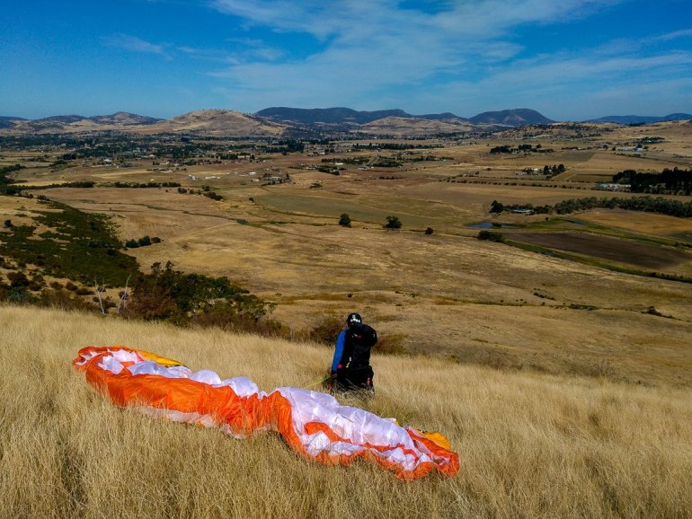 Figure 10: Rob Steane waiting to launch, Winton. Pic: Vit Peyr.
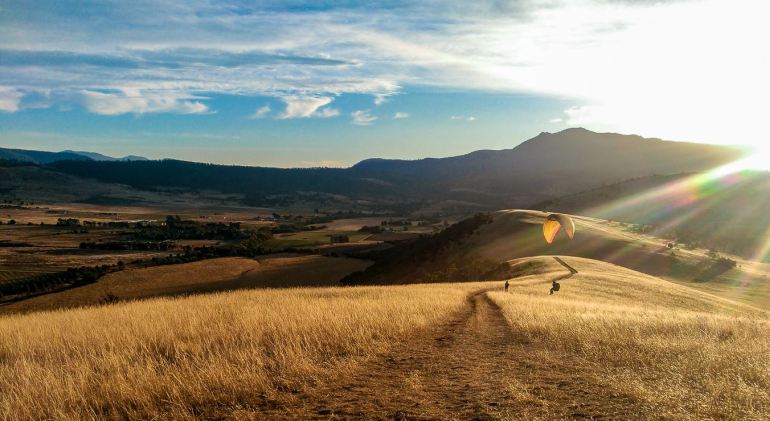 Figure 11: Lev Bodrossy top-landing in a Winton sunset. Pic: Vit Peyr.
Mt Wellington/kunanyi
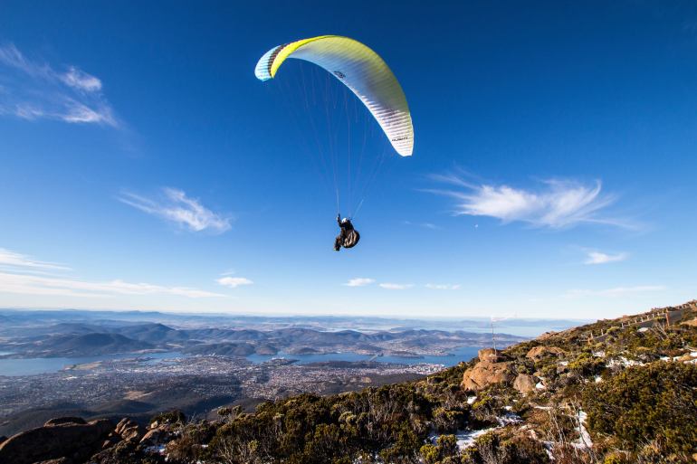 Figure 12: Peter Colman on his way from Mt. Wellington/kunanyi, this Winter. Pic: Luke Denniss.
Derwent Valley
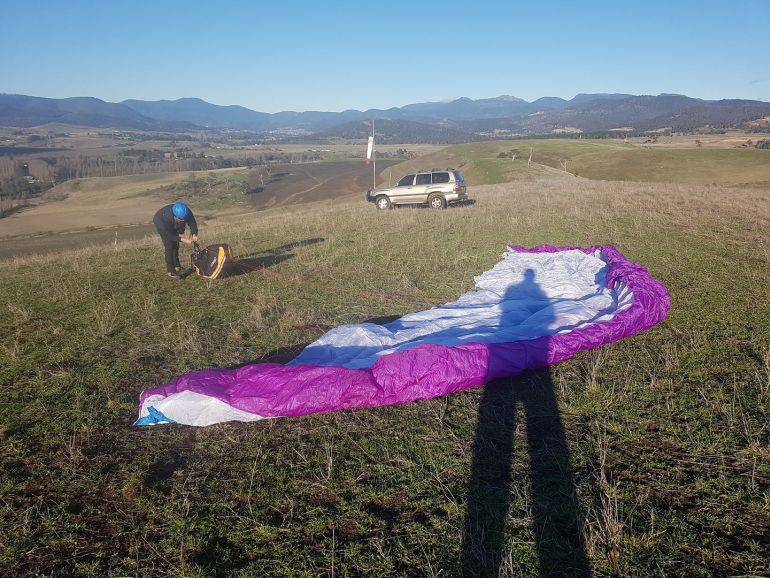 Figure 13: Iain Clarke setting up for a mid-winter sleddie. Glenleith, Lower Derwent Valley. Pic: Rob Steane.
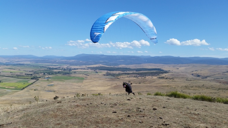 Figure 14: Ramon Brasnja goes for it. Home Hill, Ouse, Upper Derwent Valley. Pic: Iain Clarke.
Eaglehawk Neck
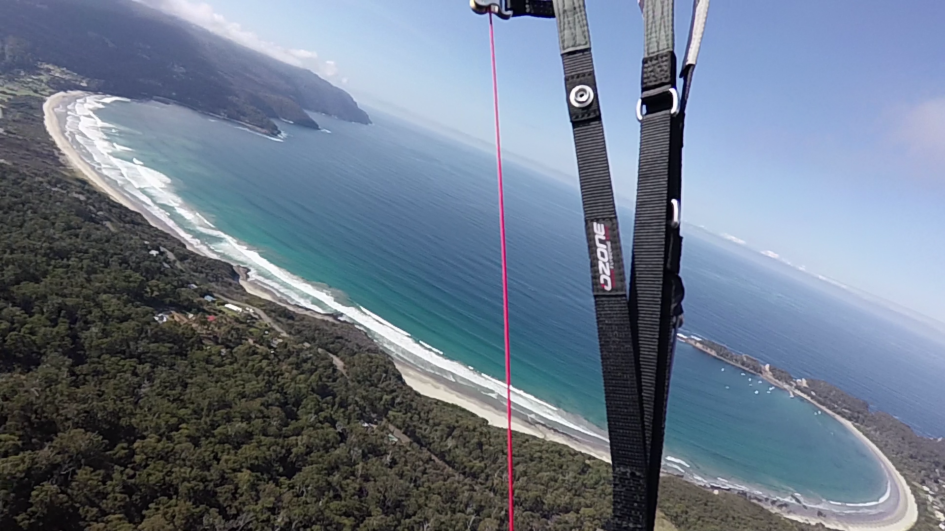 Figure 15: Pirates Bay, Eaglehawk Neck. Pic: Iain Clarke.
 Figure 16: Mark Harrison headed to Pirates Bay, Eaglehawk Neck. Pic: Phil Joughin.
Other:
SW Wilderness Area
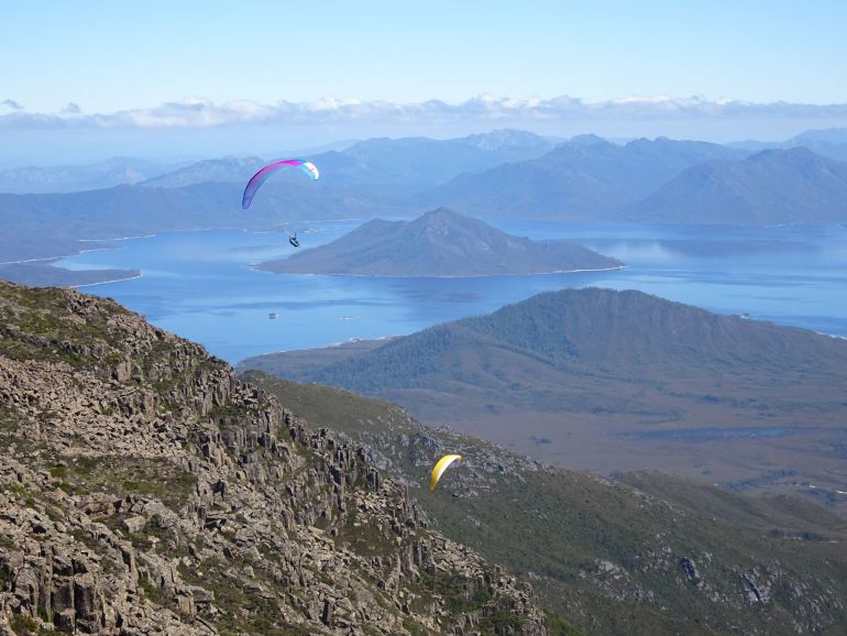 Figure 17: Loz Besnard (l) and Phil Joughin (r) over Mt. Anne with Lake Pedder behind, South-west World Heritage
Wilderness Area. Pic: Nick Neynens.
Figure 17: Loz Besnard (l) and Phil Joughin (r) over Mt. Anne with Lake Pedder behind, South-west World Heritage
Wilderness Area. Pic: Nick Neynens.
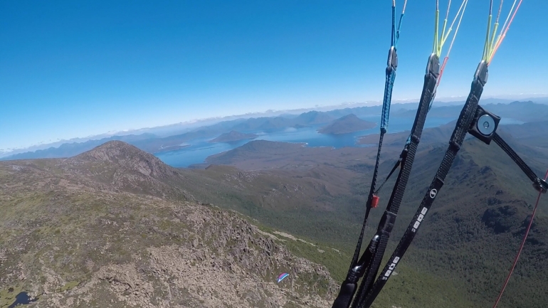 Figure 18: Loz Besnard over Mt. Anne. Pic: Phil Joughin.