New South Wales > Newcastle
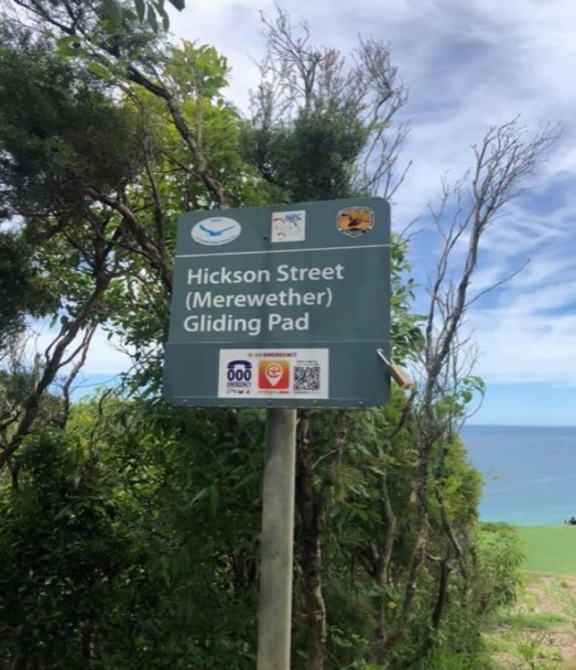
Merewether - Hickson Street Lookout
| Type | Coastal ridge |
| Conditions | S - SSE (175° – 135° True), soarable over 10 knots |
| Height | |
| Rating | South facing PG2 • East face PG3 with supervision • PG5 rating is required to fly North of Hickson Street, Merewether • HG Supervised |


The land is administered by the NSW National Parks and Wildlife Service who ask that we keep to established paths.
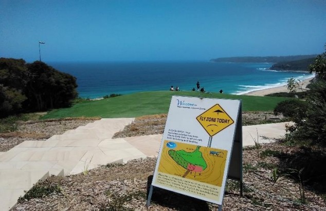
- Parking is off Hickson street near the telecommunication towers at the summit.
- There is a 100m walk to the set-up area.
There are no ablution facilities or running water available. The closest is at Merewether Surf club they also have a snack bar available.
Landowners
Land administered by the NSW National Parks and Wildlife Service
Contact/Responsible
NPC Newcastle, NSW, NHGCDescription
Airspace
Non-Active – But is a VFR flight corridor for aircraft transiting north and south from 500ft
Emergency Contacts
- Emergency Call 000
- Merewether Fire Station (02) 4963 4743
- Newcastle Police Station (02) 4929 0999
- Westpac Rescue Helicopter (02) 4952 0000
- Tony Barton – 0412 607 815
- What Three Words - App
Etiquette
- Hickson has 3 signs with numeric padlocks. (Code is 2291)
- Please lock signs at end of day.
- Please don’t park in front of the gate.
- During Summer months launch can be very overcrowded with tourists and viewers, be sure to make everyone known that you are launching or landing.
- A duty pilot is normally active during summer to tell over eager viewers to stand clear as pilot is landing.
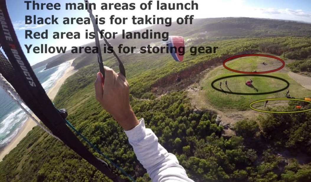
- There is plenty of space at launch, have a look below on how to use it best.
- Remember we are representatives of SAFA, NPC & NHGC and how we react to crowds and people will either harm the sport or promote it, be kind and courteous to the public. Do not get into altercations with members of the public.
Weather Stations
Holfuy: Dixon Park, wind & weather report Newcastle (Coastal) NSW Weather Forecast & Live Wind/Surf Report (seabreeze.com.au) Tempest (tempestwx.com)
Takeoff
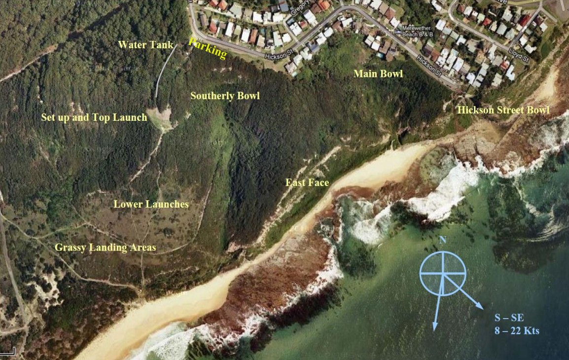
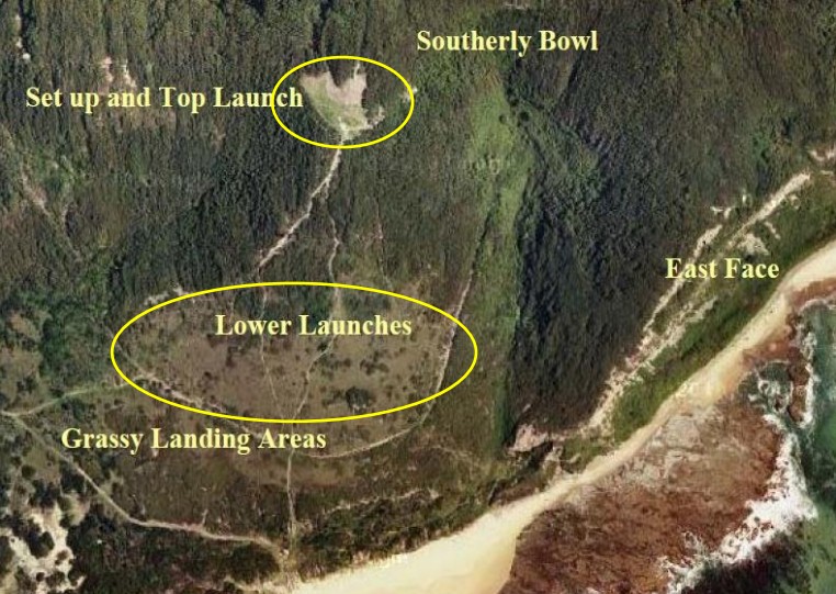
There are 3 launches, all are grassy, gently sloping downhill:
- One on top adjacent to set-up area (91 metres ASL)
- Two further down the hill – only to be used when weddings are on, or wind is too strong at top launch.
Landing
There are 4 options for landings:
- Beach – easiest of them all. There is plenty of sand to use for running out the landing.
- Grass at the bottom of the hill – can be tricky if the wind is southerly. Lose height over the flat land between launch and water treatment works. Make an approach to the grass patches at the bottom of the hill. Most low airtime pilots choose this option.
- Transit to Dickson Park beach – if you don’t mind the walk back up the hill to collect your car. If you have 400 feet at the Hickson Street Bowl, you can make the beach in front of Dickson Park in a novice glider although this is for PG4 and above.
- Top landing – Can be very tricky when its direct South due to wind straight up hill. Before attempting seek guidance from an experienced pilot and make many practice approaches.
Flight
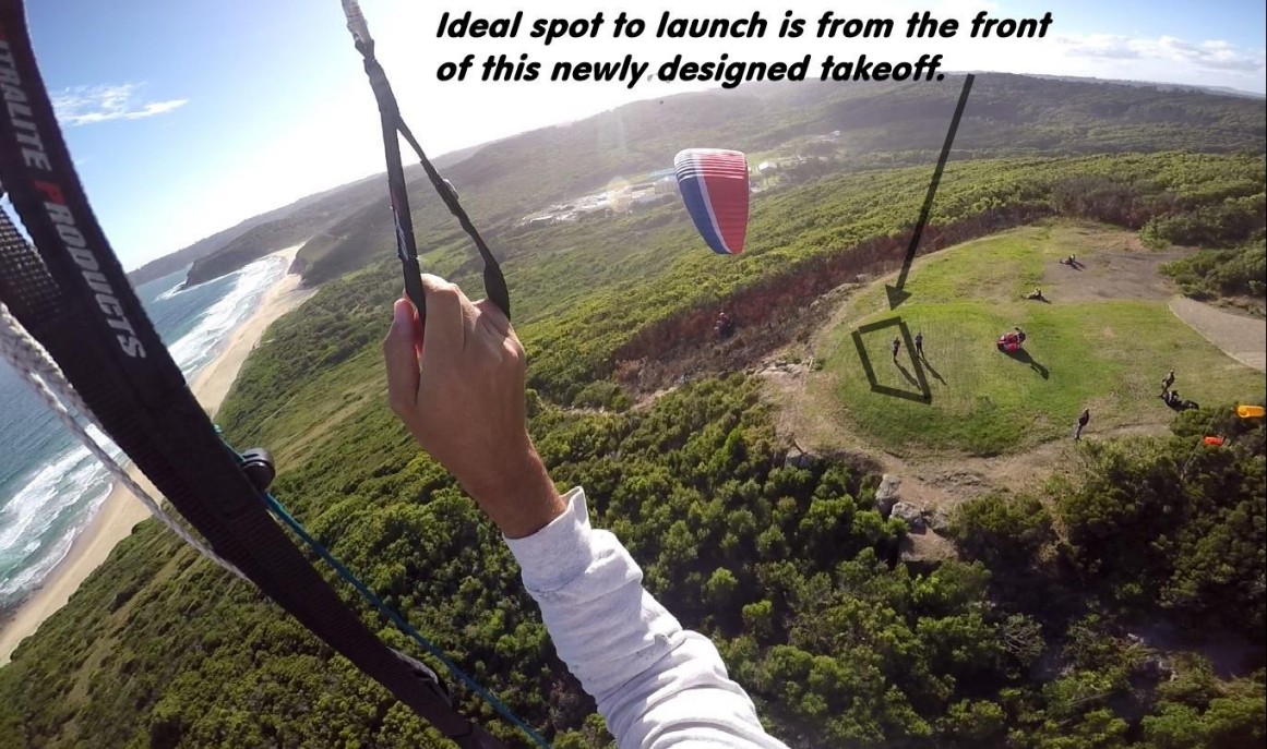
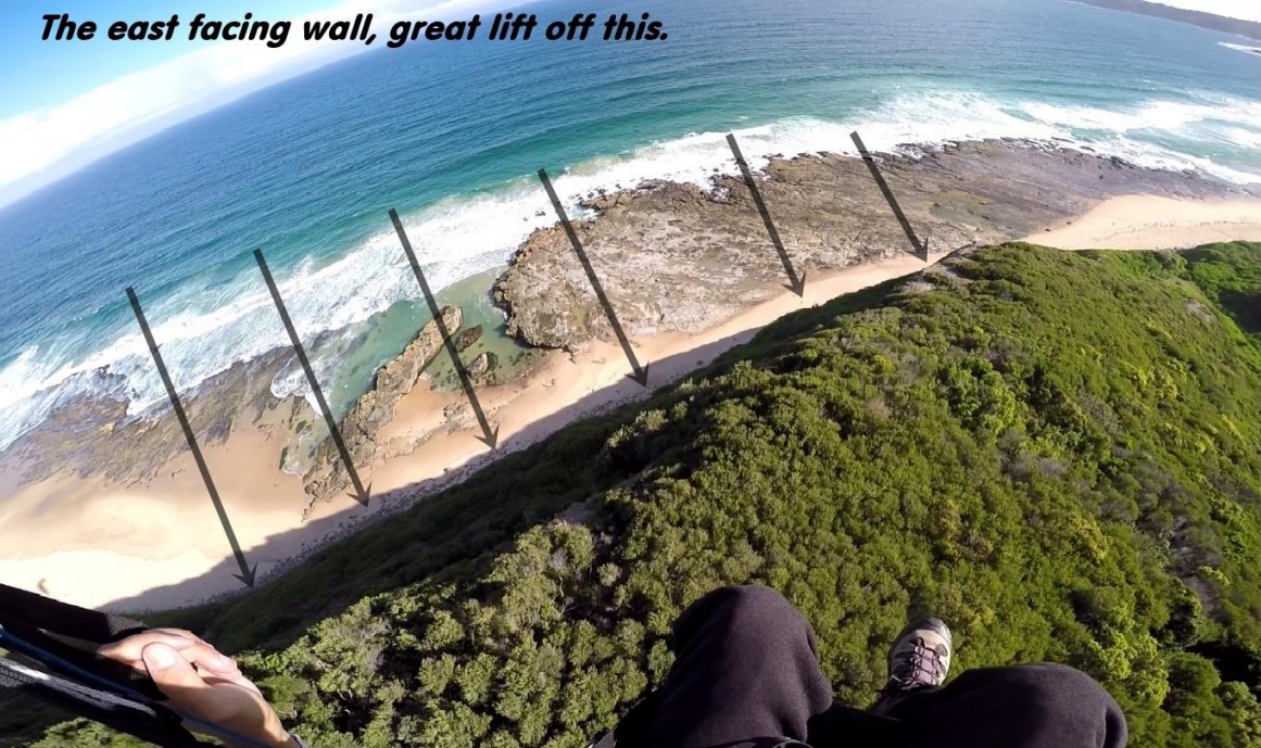
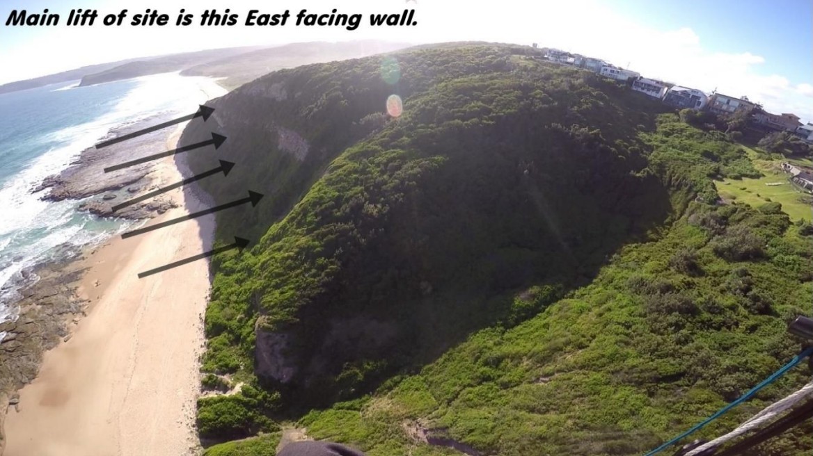
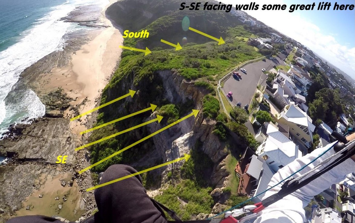
- When the wind is direct south, the lift is good across the Front of entire site.
- Heights up to 800 feet ASL are possible.
- Crossing from the Hickson Street Bowl in a straight line to launch in Southerly conditions is possible particularly if you have 200 feet AGL.
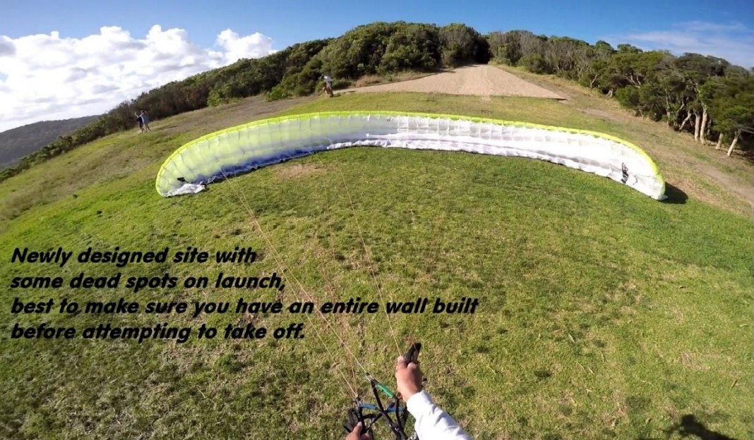
- You may encounter some dead spots on launch when bringing up the wing. Make sure you have an entire wall built before attempting to take off.
- If wind is pushing 14-16 knots its safer to walk a few minutes down below and launch from the below launches, also if it’s too strong up top, consider another day.
- Glenrock State Conservation Area | NSW National Parks
Hazards / Comments
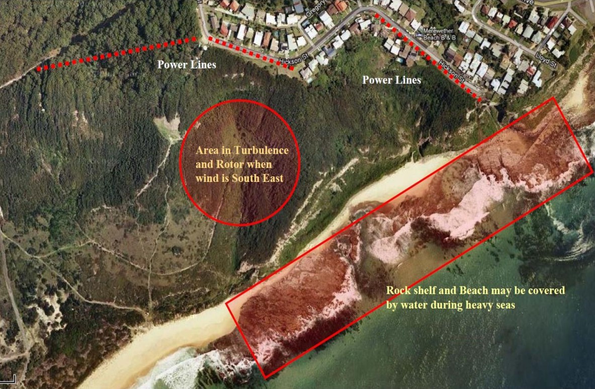
- When the wind is out of the Southeast there is a vicious rotor and turbulence behind the east face cliff. Avoid this area and fly around the front of the east face to transit back to Launch.
- Power lines along Hickson St at the back of the southerly bowl and the main bowl.
- Power lines running from the telecommunication towers down to the water treatment works about 500m west of take-off.
- Big seas during high tide can cover the rock shelf in front of the East face all the way north past the Merewether baths. If there is no sand in view on the beach in front of launch and the conditions are light, don’t go to the East face. You might not have a place to land.