New South Wales > New England
Manilla - Mt Borah

| Type | Inland Hill |
| Conditions | All |
| Height | 820-880m / 2500-2700ft asl |
| Rating | PG2, HG Intermediate |
- West launch Navigate Map
- East launch Navigate Map
- South launch Navigate Map
- Northeast launch Navigate Map
15km north of Manilla along the Wimbourne Rd. Drive over the big Namoi River bridge, turn left after 200m on to the Boggabri Rd, drive 1km, turn right at the Mt Borah sign with coloured streamers, after 11kms you will be at the base of Mt Borah. There is now good (although unsealed) road to the top of the hill - it is closed when wet! A diesel engine powered four-wheel drive vehicle is required to negotiate the direct road to the west landing zone. Manilla Paragliding school can arrange a shuttle service from their HQ at the bottom of the hill.
Landowners
Most of Mt Borah is owned by local Paragliding Instructor (and PG Open Distance World record holder 98-02), Godfrey Wenness. His website is www.flymanilla.com.
Contact/Responsible
Godfrey Wenness (+61 (0)2 6785 6545), Manilla Sky SailorsDescription
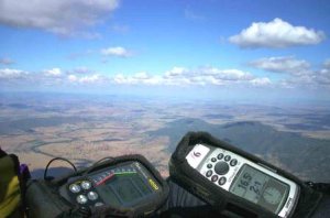
There are flatlands right in front of the Mt Borah site. This area of Northwest NSW is perfect for cross country (XC) flying in that there are some small hills and ridges dotted in amongst the flatlands. This makes for reliable thermal triggers, easier navigation on big XC flights and virtually no problems with lee side. The countryside is also well covered by UHF CB repeaters providing excellent radio coverage. The club's Mt Borah weather station is accessible via the web.
Takeoff
West launch
This is the main launch. Even if it's over the back here in the morning, it nearly always comes on once the sun gets to the W face. If you set up a hangie anywhere else you risk having to do the 'Borah shuffle' later when the wind switches W.
East launch
This launch can work in the morning. The launch is quite flat, as is the glide out to the bombout. The hangie launch is down a little to the left where it gets steeper.
Northeast launch
Fairly flat.
Landing
The landing zones at the bottom of the hill are at 400-450m / 1200-1350ft. Hangies should be aware that the W bombout slopes down significantly to the SSW. Top landing at Mt Borah is possible for PGs in the large cleared areas behind the launches, but watch out for the sink cycles. Landings can be made anywhere in the region provided you observe the standard rules of leaving gates as you find them, don't drive off established tracks and avoid landing in cropped fields. Say hello to the farmers if you see them - you never know they might invite you in for a cold beer and then give you a lift to town!
Hazards / Comments
There are no peculiarities other than to land in the designated bomb out areas directly infront of launch (refer to the site guides on launch) and to avoid flying in the middle of the day during summer if you are inexperienced and don't want a rollercoaster ride.