Queensland
Wilson's
| Type | Hill launch |
| Conditions | NE |
| Height | 718 m |
| Rating | PG4 |


The launch is near 89 Wilson's Rd, Ramsay. The landing zone is near Walkers Rd, Rockmount.
Landowners
The landowners have asked us to keep all gates as we find them, and not to park any cars on the paddock between the road and the launch. It's fine to park cars on launch, behind the last gate. Please contact the Wicked Wings club before you go flying there.
Contact/Responsible
Wicked Wings Para/Hang Gliding ClubDescription
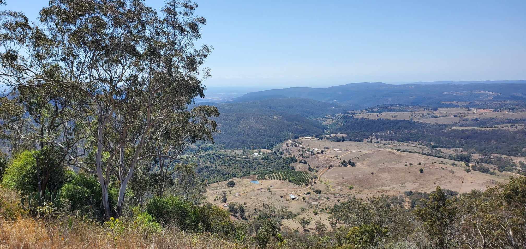
Wilson's is a beautiful hill launch with a mini-ridge south of Toowoomba on the outer edge of the range. This location offers good XC conditions, as we can either fly with the wind over the flatlands or head south along the range. The ridge is quite small, so it's not ideal for afternoon ridge soaring. This site is mostly used for thermal flights.
Takeoff
The launch is surrounded by high trees on both sides, so does not tolerate a lot of crosswind. Good thermals can usually be found on the ridge either side of the launch or further down near the landing area.
Landing
The landing zone is near Walker's road and is a little hilly. The best approach is usually to stay above the highest points of the hilly paddock to avoid getting too much sink. The best landing area is close to the watertanks and gate on the green patch, but overshooting will get you into trouble there (because of fences and powerlines).
Flight
Wilson's offers good XC conditions. On weekdays, Amberley restricted airspace is likely active and limits us to 8,500 ft or 2,590m above launch. To the west and north are further airspaces: Wellcamp and Toowoomba CTAFs (VHF: 127.65 for both), and Oakey CTR as well as further restricted airspace (especially on weekdays). The best approach is to head SW, away from all airspaces.
Hazards / Comments
The launch is surrounded by high trees and cannot take a lot of crosswind. Plus, the wind on launch is often stronger because of the venturi. The landing area is fenced and there is a fence between two paddocks about mid-way to the road that can be difficult to see. Along the road are power lines.
Map information
