Victoria > West Inland
Gordon
| Type | Inland Hill |
| Conditions | S, SE, ESE (fair), SSW(difficult) |
| Height | 400'/ 120m agl, 2200'/670m amsl |
| Rating | PG2 / HG Supervised (PG4 / HG Intermediate?) |


At the township of Gordon on the Western Freeway just before Ballarat. From the Gordon Pub (20km east of Ballarat on the Western freeway) head west to pass on the north side of the hill. The site is entered from the western side (the back) through a gate just south of the troop of Cyprus trees and the small house. The track passes around the north face and into the crater. Please try and minimize damage to the access track. BE SURE TO LEAVE ALL GATES AS YOU FOUND THEM. Vic roads Map 77 C3.
000 Emergency Markers (?)
- GOR100: South launch
- GOR200: Landing - South paddock
Landowners
Privately owned. It is very easy to lose sites on private land, so please consider the owners opinions of your actions. Dogs, for example, are best left at home.
Contact
Gary Hickson (0408 401 588), WVHGCResponsible
WVHGCDescription
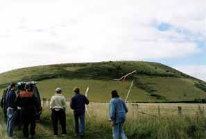
Mt Black (Gordon) is a rounded, grassy volcanic hill with an easy open take off and landing. Farm track provides access to the crater and thence to the SE launch, if traction is good. Walk the last 150ft on the south side. On top landings are possible on the south side, but difficult due to a fence on the SE side.
Takeoff
It is generally unnecessary to ask prior permission to fly, however please use common sense. From time to time the access paddock is ploughed for crops and therefore may not be used. Also, several of the landing paddocks may be unusable due to crops.
Landing
Three landing areas are available as indicated on the map:
West paddock - large open paddock with no fences or power lines.
South paddock - just to east of dam. Beware of the diagonal power line that runs across paddock to east of dam.
East paddock - to east of launch. Beware of power line that runs along the fence line that runs east on south side of paddock.
The three paddocks directly below the SE takeoff. Avoid these paddocks if they are in use for cropping or have livestock in them. 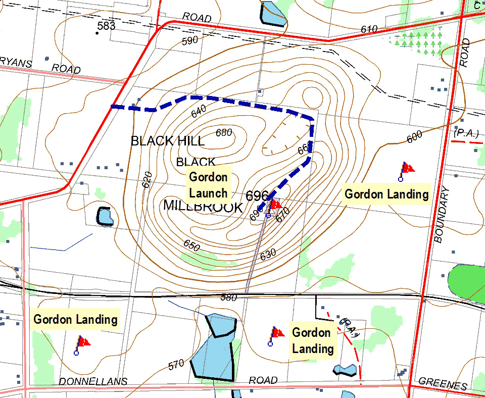
Flight
Both faces provide similarly good soaring prospects in moderate winds. Most Southerlies are unstable and produce good lift (along with sink and turbulence). South Easterly sea breezes often provide smooth ridge soaring in the late afternoon with adequate if a little disappointing height gains.
Hazards / Comments
The surrounding countryside is green and rolling and very picturesque if you get high. Unfortunately this will put you into the flight path of light aircraft flying between Melbourne and Ballarat, keep a good lookout at all times as light aircraft have passed over this hill at less that 200'. Particular care is needed between the hill and the freeway. Be aware of the power line which runs from the road directly to the group of trees below the trig point on the SE side.
Map information
