Victoria > East Coast
Portsea

| Type | Coastal dunes/cliffs |
| Conditions | S-SW up to 20kts maximum |
| Height | 70' / 20m asl |
| Rating | PG2 / HG Supervised |
East coast near Port Phillip Bay heads. Melways Map 156 A5.
000 Emergency Markers (?)
- MOR548: Launch
Landowners
Parks Victoria. This site is licensed by Parks Victoria to the VHPA via SAFA
Contact
SkyhighResponsible
MHGC , SkyhighDescription
The site is within the Mornington Peninsula National Park so pilots should respect and enjoy the environment. Most importantly that means take-off cleanly from the ramp, land on the beach and return via the main access track. NO scrambling up and down the cliffs or dunes! Stay out of the sand dunes completely to protect their structure and to protect the birds and animals that live there. This means that flying operations of launching and landing are to be confined to the launch area, the beach and the interconnecting ramp.
All of the beach may be used for landing and part, but not all, of the beach can be used for ground handling practice as well. However, launching from the beach at Portsea is not permitted.
The beach area where ground handling is NOT permitted runs between the beach access ramp and a point 200 m west of the access ramp - see map.
Beach nesting birds: Hooded Plovers nest in this area. Visit this page to learn more.
Takeoff
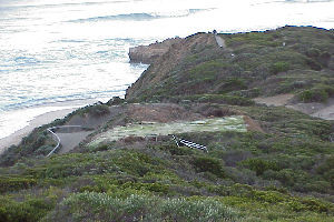
The path to the launch from the carpark leads to a glider set-up area, out of the wind on the right, and the synthetic turf take-off ramp to the left (see photo). Pilots should set up with the aim to being airborne about 1m before the edge of the ramp. For paragliders that means standing about 3m back from the edge before inflating the glider and being sure to keep quickly pulling the canopy up until its flying above your head - if you don't you'll get dragged back into the scrub!
Landing
Top landing on launch or landing on the beach. Beware the beach slopes quite dramatically and can be very difficult for hang gliders to land. The wind slightly off to west and tide fully out provides the best opportunity for landing. The beach widens towards London Bridge, watch for turbulence.
Flight
The total flyable distance is 8km. When flying below the point to the left of takeoff, be wary of the slight rotor which has claimed many kites.
Flying to the Rip should only be attempted when the wind is off to the right (west) at takeoff.
The dangers to watch out for are:
- The rotor behind London Bridge (more than one glider has crashed behind the Bridge).
- At high tide there is no landing area on the beach at some sections.
- The points in between the bays can be hazardous, and even more dangerous if the run is attempted with a wind which is not off to the right at takeoff. If at any stage of the run you should land, a long hard walk is in front of you, and if you are injured, help may be some time in getting to you.
On an average day, heights of 300ft or so above launch are normal. The site record is probably held by Ken Hess in an Icarus V, with about 1000ft above, back in the late 70's.
Hazards / Comments
Spectators crowding around the takeoff and landing area, small or nil landing area at high tide, and power lines near the life saving club.